Stage six - Edge (Maitlands wood) to Dursley
One day, four sites, zero flights

Two months on, and considerably warmer weather and our story continues. We'd eyed up our next day to continue the walk: Probability of sun; fair to good; not too hot; and most importantly, likelihood of rain; nil. The best bit was, we could catch the bus from the end of our road and be at the start point within 15 minutes.


 A humorous, if a little creepy and unexpected scene greeted us as we passed by the farm. Within another few minutes, we had reached the summit of the hill's western end and were standing by the trig point soaking in it's wonderful view to the south and west. This was one of the four 'sites' we were to visit today, out of their usual context for me (an explanation later). Next, leaving Haresfield behind we headed east then south through Standish woods, with occasional views off toward the Severn again, now an enduring feature along the route. Coming out of the woods and heading downhill across some beautiful meadows, we crossed a couple of roads. One crossing had a slightly ambiguous marker, so that we were unsure which of two obvious routes we should follow. Of course, we chose the wrong one, which led to the inevitable slight diversion, but we were soon back on track.
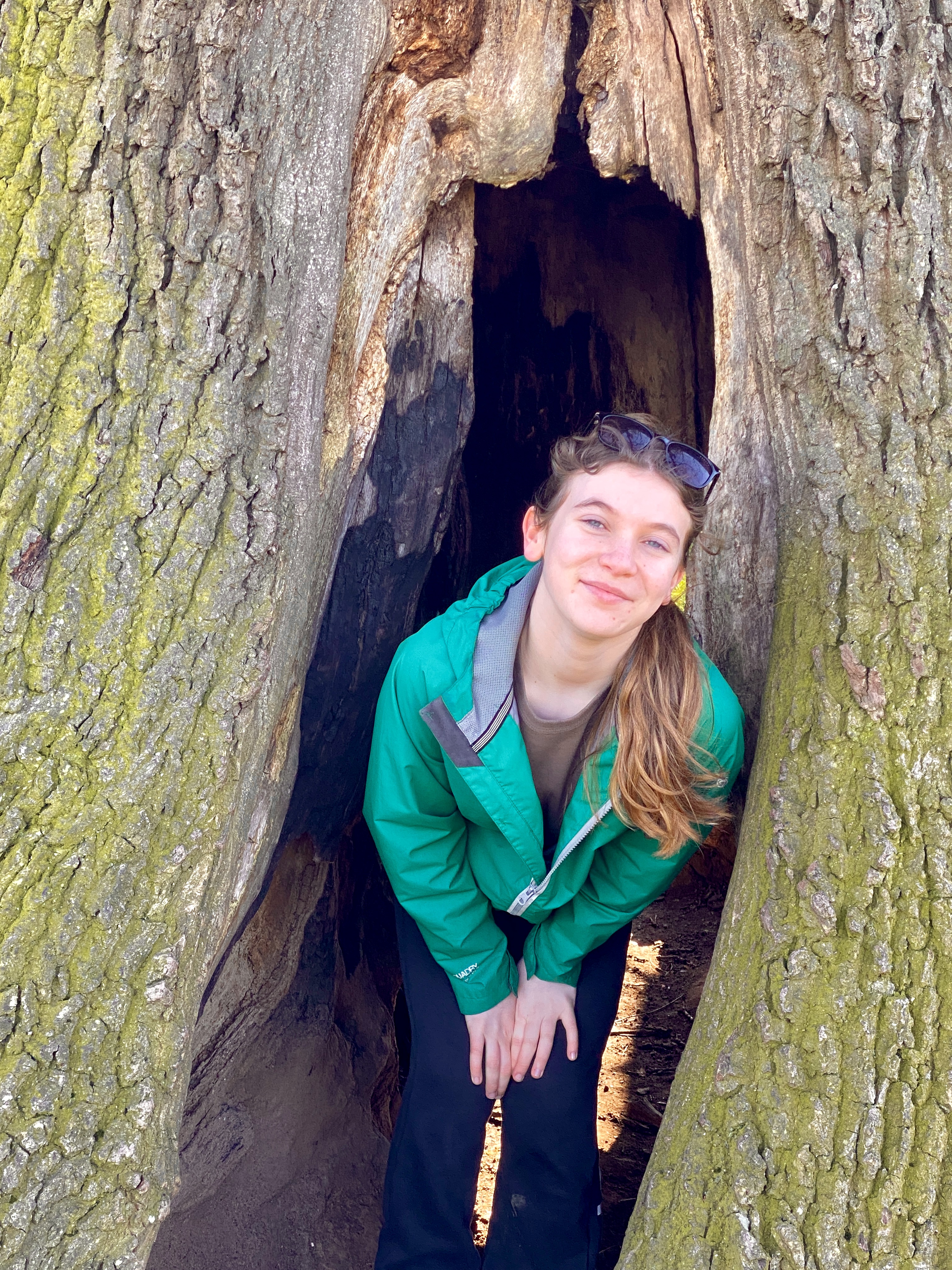
 Across a few more meadows, steadily descending, we found the 'Faerie Tree', which overlooks Ebley and Stonehouse some way below.
 We had planned to do the longer variation, taking in Selsley Common, despite the fact that we've been up there many times before. The canal path alongside the Stoudwater Navigation was closed at the path junction, for some repairs, so we were forced to divert down to the road, before heading back through the cricket ground to rejoin the tow path again, just for a short way. From here the path cuts away through a small estate, then across the fields, then across the busy road, before climbing steadily to Selsley village, up past the All Saint's church
 Just past the church, the route rises again and here we decided to take our lunch break and take in the views back along the way we had trodden.
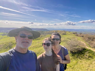
 After a short break, we were on our way again and over the top of Selsley Common; the second 'site' (more to come). As is now becoming the common theme, we descended into Pen Woods, where the path follows the forest, shadowing the road above between here and Coaley Peak. The way marking here is a little erratic, but knowing that we must arrive at the top of Coaley Peak, we followed several routes, eventually finding the official route again before arriving at the very familiar picnic area well-known to us as 'Frocester' (actually a village a mile or so from the hill to the WNW). This was 'site number three of the day. What are these 'sites'? These are places I frequent to engage in my main hobby/pastime of paragliding. I have seen all of these places from several hundred, sometimes thousands of feet from the air and here I was on a beautiful day, enjoying them all with my lovely family at ground level.
 This was the point where we needed to make a careful decision; whether to continue the journey to Dursley, another 4 miles or so, which would make the next stage much easier to access the start point, or to head about a mile to Nympsfield, from where we could simply get a bus (or perhaps two) home. After some rest and deliberation, we chose the harder option, to carry on to Dursley. I knew I was going to initially regret making that decision as I was really hurting by this point, but I also knew we'd feel very satisfied at the end. So, onward we plodded, making all sorts of promises to Lara about choclate brownies and the like. The first stage, inevitably was a huge descent (which causes me the most pain, especially later on in a walk). Once down, we of course knew the next part was... yes, going back up! The route crosses from the main escarpment here, to a lovely flat-topped, L-shaped hill called 'Cam Long Down, 'CLD', as we refer to it and site number four. From Coaley Peak, CLD had looked quite small, but by the time we were directly below it, it was now looking fairly formidable in our weakened state!
 As you can see, I find uphill much easier; less impact on ageing knees and sore achilles tendons. However, by this point, everything was starting to really hurt, uphill, downhill, or level paths alike. Nevertheless, we were soon up on top of this relatively small hill and enjoying the views a full 360º.
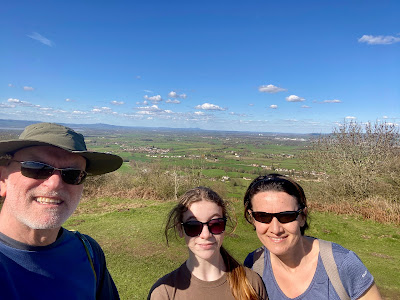
 Once along the crest of the hill, the short descent started down the southern aspect, to the point just before the smaller Cam Peak immediately south and well worth a look if you haven't been here before. Since we have and our route turns SE, we headed that way and down further through various fields and past an intriguing old castle/stately home of unknown (to me) name. From here we were just a few short steps from civilisation and.... a pub for me! Lara and mum went off in search of some form of cakey bribe for Lara and we met up about 20 minutes later in order to work out our route home, which turned out to be two buses, first the 65 to Oldbury near Stonehouse and then the number 64, which heads to Gloucester, once again passing the end of our road. We had originally hoped that one version of the 65 would take us all the way to Gloucester, although that would have entailed about a 15 minute walk home. We were certainly glad of not having to make the extra steps, getting off instead about 300m from our door, pooped but happy.
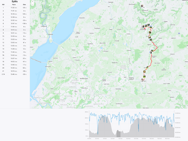
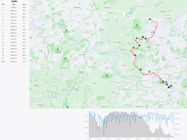
 Owing to a number of uncertainties; whether to do the Middleyard variant, or the longer Selsley one; whether we would finish at Coaley or Dursley, as well as one or two slight detours due to resurfacing work and minor errors in navigation, we were not sure how far the final distance would be. Now, having completed the stage, we could see the full distance walked on the day; 28km, or 17 miles nominally, the longest stage we've completed to date. Hopefully, that now places us in a good place to progress on next time. So, until then, good luck if you are walking any part of the 'Way' and we'll update when we've completed some more!

Within minutes we were on our way...


As seems to be the 'norm' now, we began the day with... giving up a considerable amount of height. The route from Maitland's wood descends past Stockend, affording a glimpse through the trees along the way, of the view to the severn and Forest of Dean beyond. It was quite chilly at this point, as the warming of the morning sun were blocked by the hill on our east. Still, we were kept warm enough by our exertions. Soon, we were approaching and then crossing the road up to Haresfield Beacon, a route I know well and the intersection was at Ring Hill Farm.


Comments
Post a Comment